Ashland’s Watershed – An Island of Intact Forests
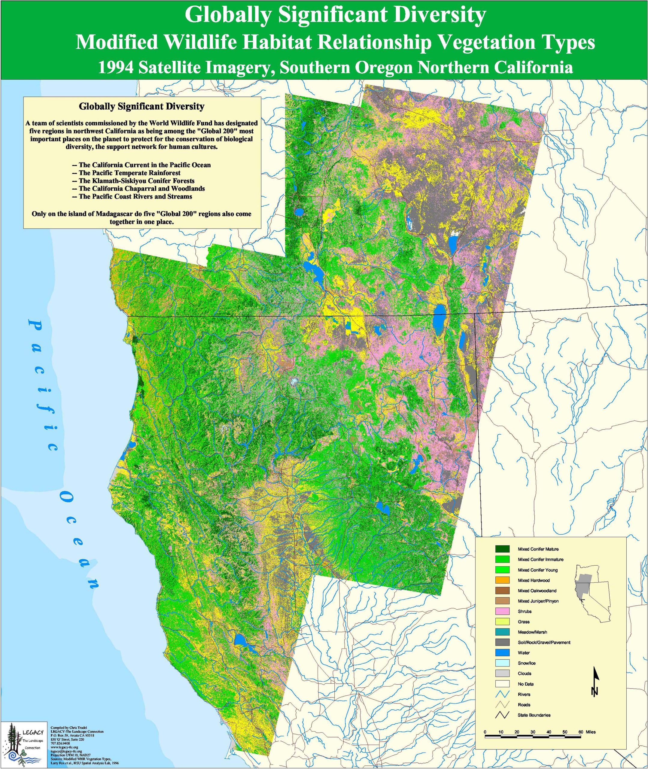
California Globally Significant Diversity
Endangered and Threatened Salmon Species
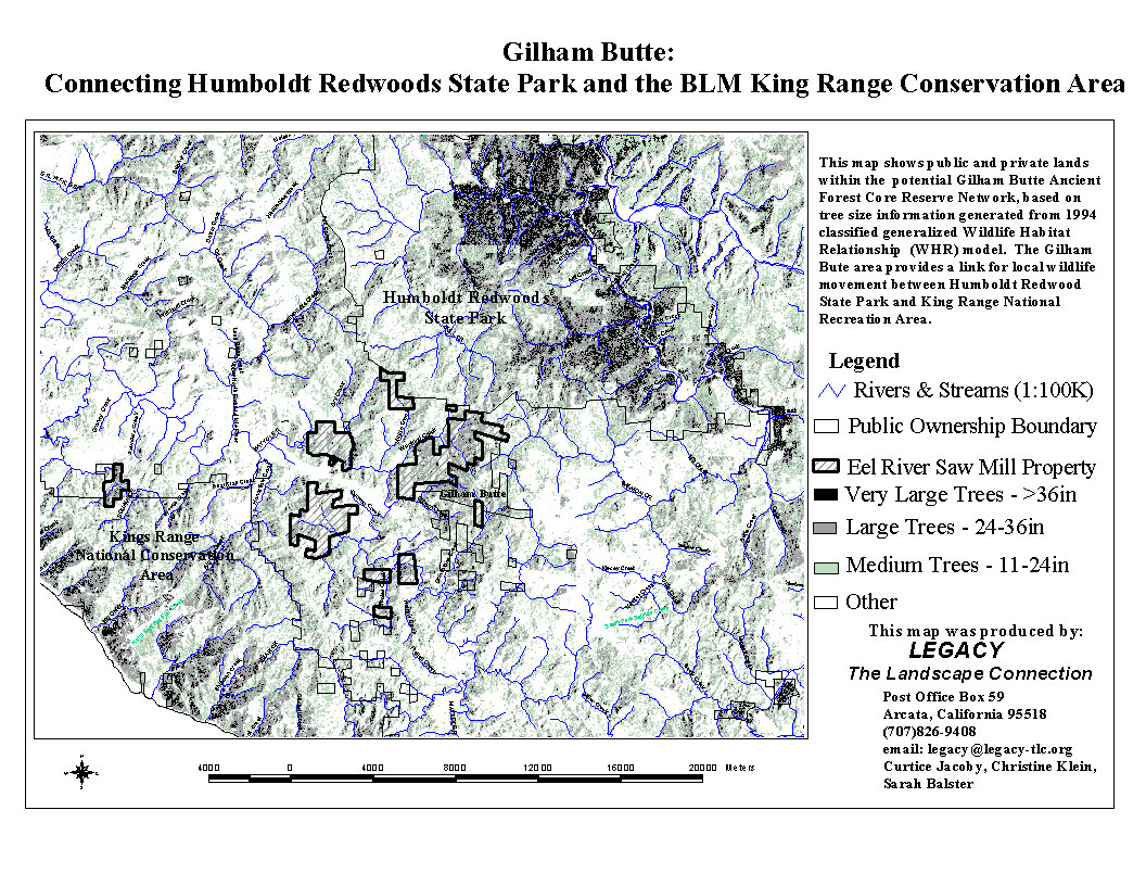
Gilham Butte-Connecting State Park and Conservation Areas
Headwaters Forest Reserve-Humboldt County
Land Ownership in the Humboldt Bay Watershed
Maximum Possible Extent-Old Growth Forests
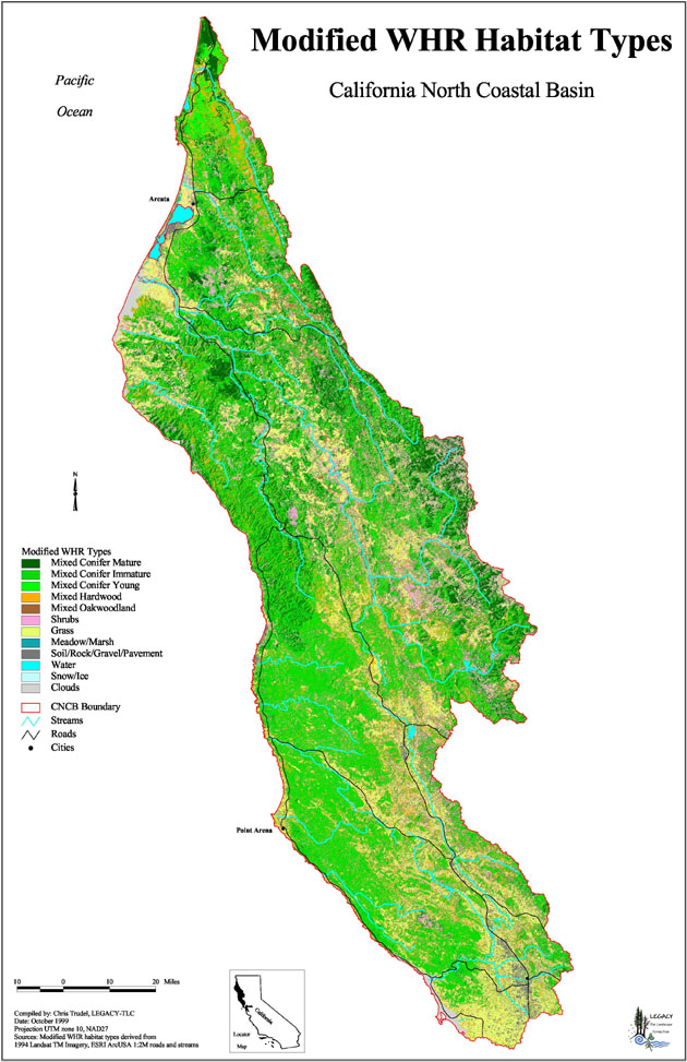
Modified Wildlife Habitat Relationship Types
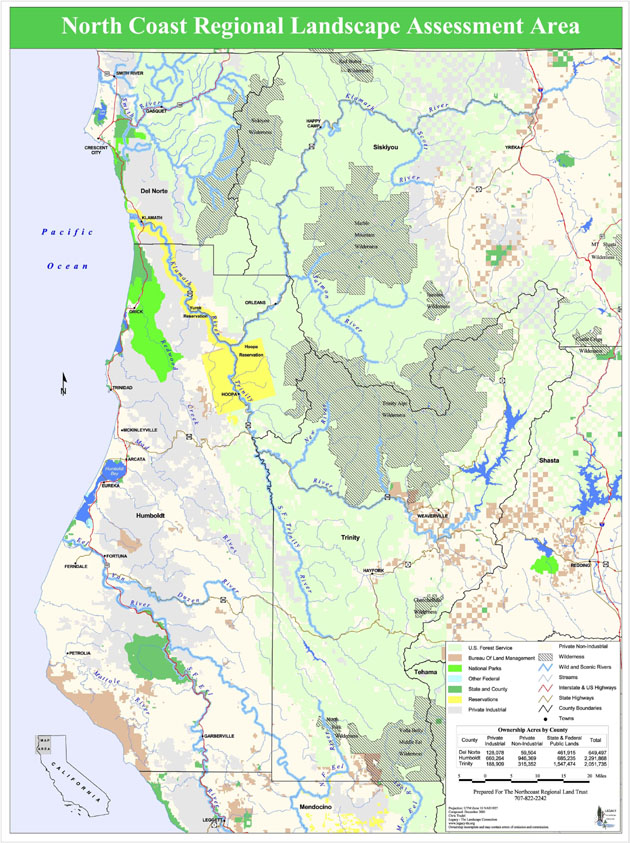
North Coast Regional Landscape Assessment Area
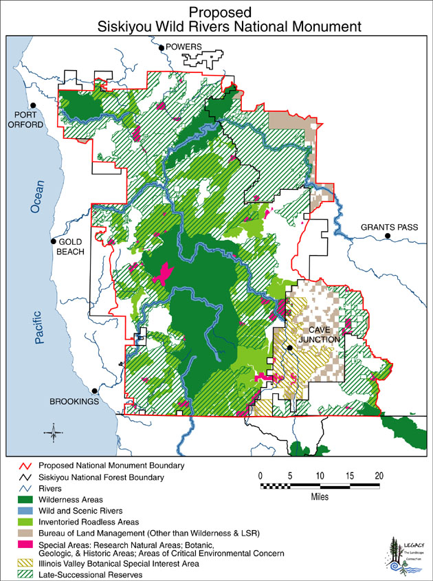
Proposed Siskiyou Wild Rivers National Monument