Landowner privacy is honored on this website. LEGACY will not post maps of private property without express permission from the landowner.
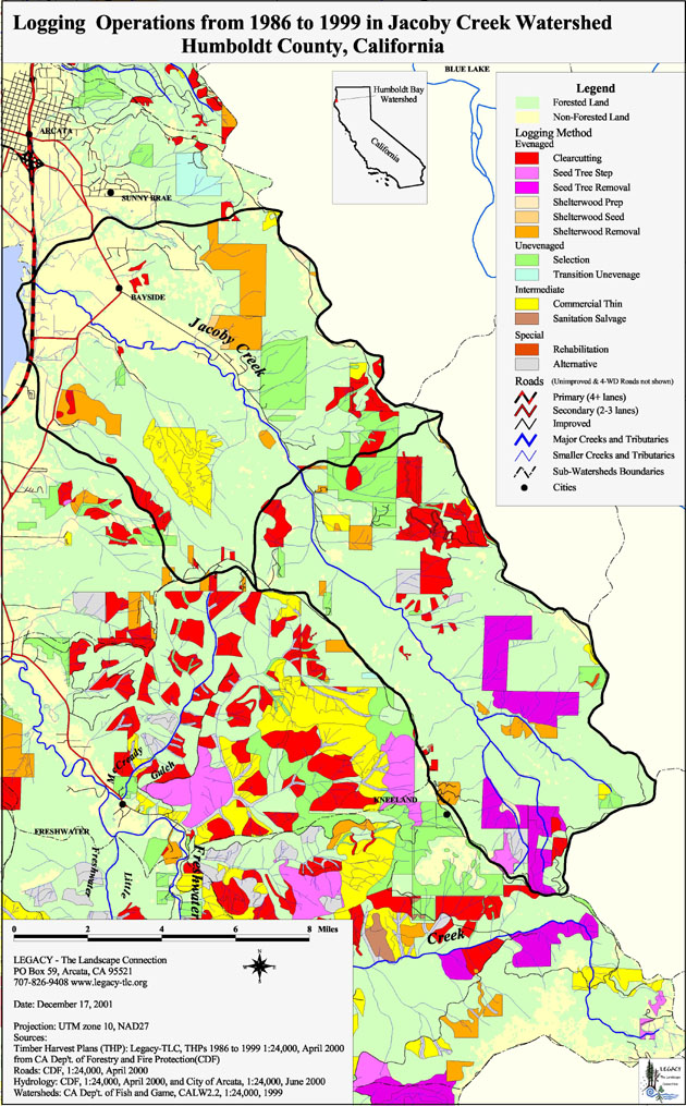
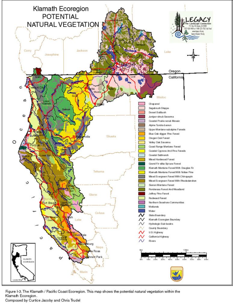
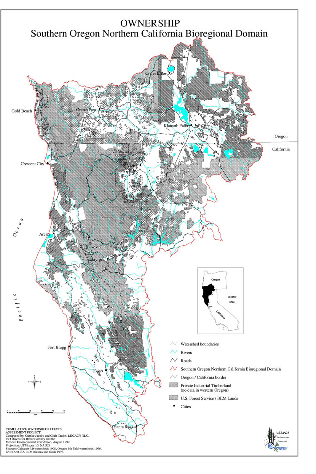
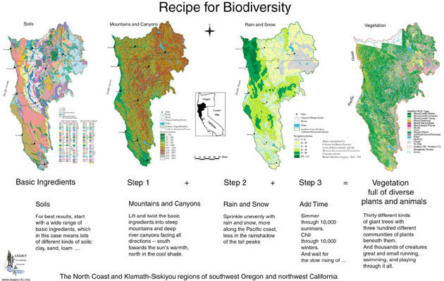
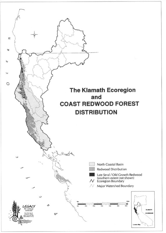
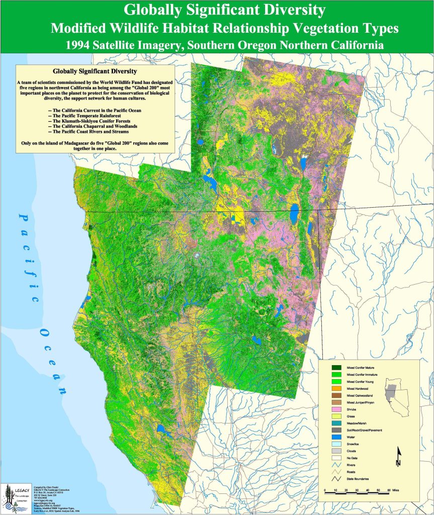
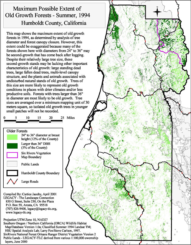
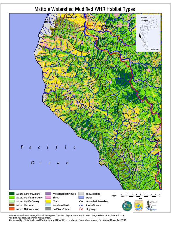
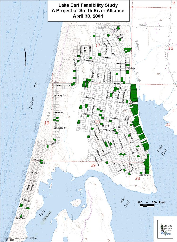
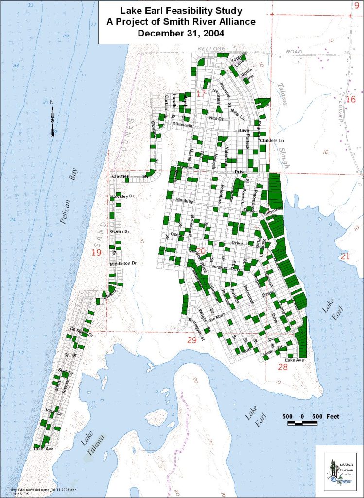
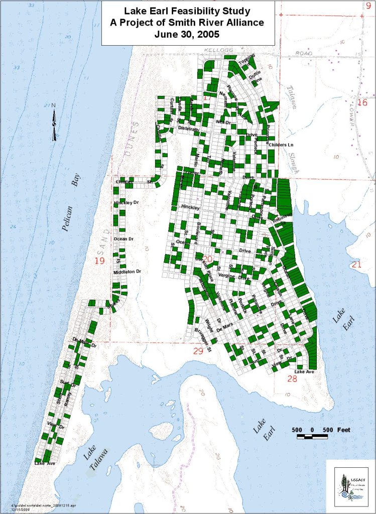
Most of the maps shown on our website are from LEGACY’s early years and are regional in nature. Recent work has focused on mapping for conservation easements, rural road erosion control plans, California Forest Improvement Program (CFIP) plans, public land acquisition from willing landowners, stream restoration projects, and non-industrial timber management plans (NTMPs). Most of this work has been for private land and most owners prefer that it not be posted on the internet.


